Colours of Iceland
The evolution of the representation of Iceland from the 1950s to 1998.
Iceland print collection here: iceland collection
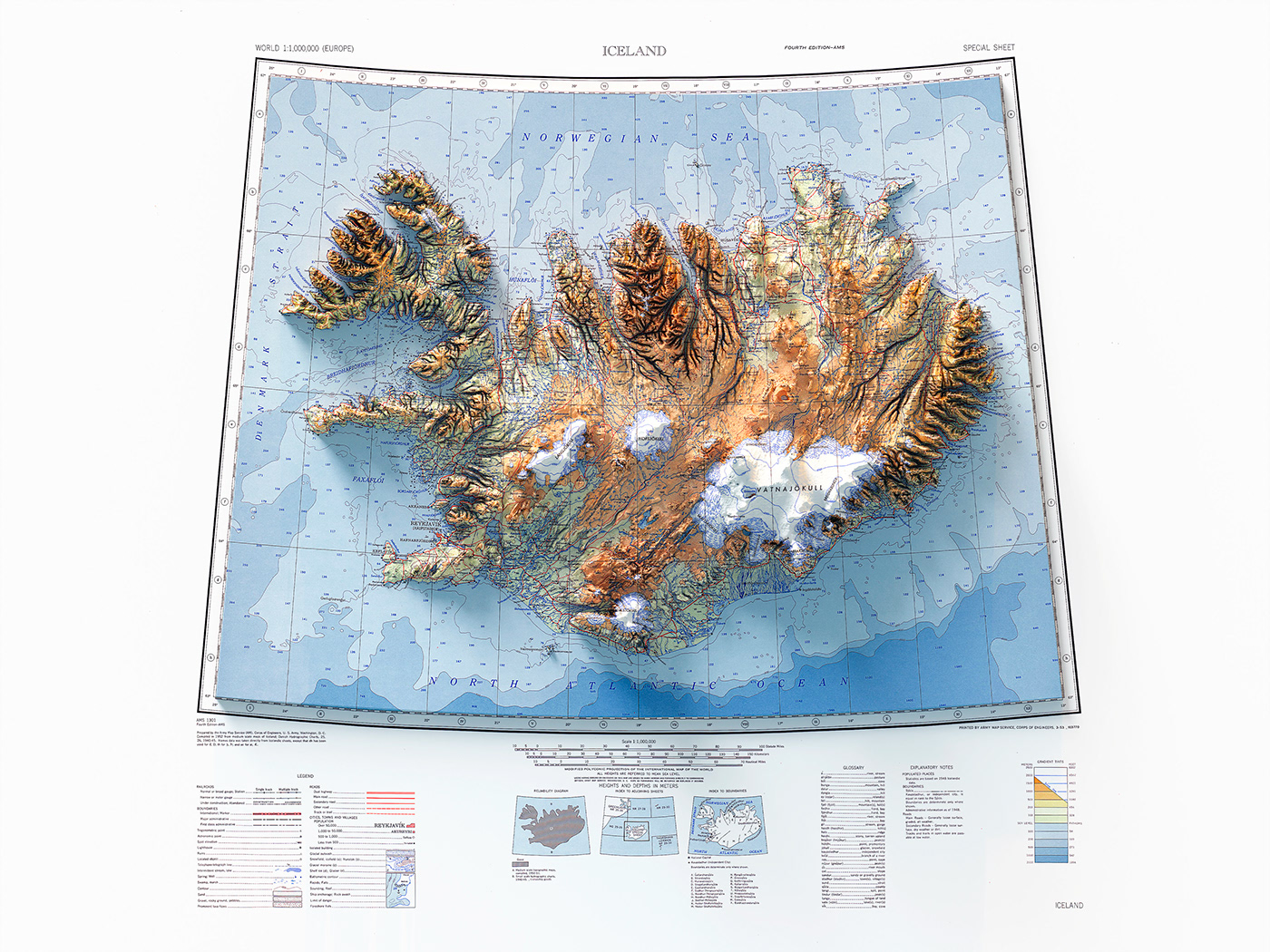
Topographic map of Iceland showing roads, tracks, boundaries, glaciers, water features, cities and towns. AMS 1301, fouth edition. Prepared by Army Map Service, Corps of Engineers, U.S. Army. Compiled in 1952 from medium scale of Iceland.
Source: University of Texas.
Source: University of Texas.


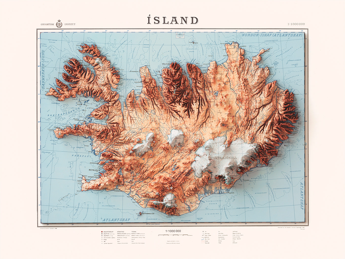
Topographic map of Iceland showing roads, tracks, boundaries, glaciers, water features, cities and towns. Relief shown by contours and spot heights. Depths shown by contours. Geodetic Institute, 1963.
Source: NLA gov.
Source: NLA gov.


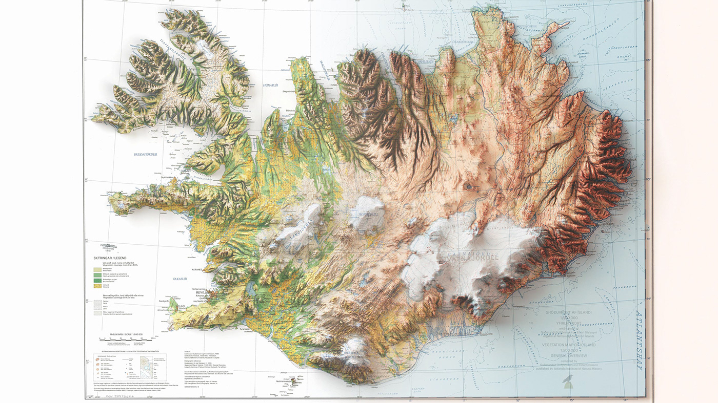
Vegetation map of Iceland 1: 500 000, overview map / compiled by Guðmundur Guðjónsson and Einar Gíslason; 1998.
Source: UW Milwaukee Libraries.
Source: UW Milwaukee Libraries.


Vizart Studio
3D cartography & dataviz
If you like our work, want to see our daily work or want to say hello to us,
Otherwise if you are interested in our prints or have a custom request check our shop vizcart.io
For inqueries or commission, feel free to contact us at hello@vizart.io


